WellDatabase & Alaska
This is just a quick follow up from our previous Alaska posts (see Alaska Data and WellDatabase Takes on Alaska). Here we will outline the data we...
You need data. You need mapping. You need tools to analyze that data. Now you can do everything in a single, easy to use platform.
Perfect for users who need access to basic well level data. If you're only interested in a few wells and currently use state sites, this plan is for you.
The industry didn't start with unconventionals and neither does our data. We cover the full historical dataset across every producing state and province. Don't settle for inferior data, check out our coverage for any state or province you're interested in.
One of our biggest requests has been the ability to export data from our database to use in other software for further analysis. Fortunately, WellDatabase handles this in a very simple way. Below is a quick guide on how to export data from WellDatabase.
Our first step is to filter data down to get the dataset you are after. For our example, we will search all of the Yates wells in Andrews County, Texas. To make things easy, here is a link to the saved search.
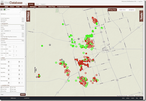
Now we’ll jump over to the List View to see the list of wells. The List View button is at the top right of the map between Map View and Analytics.
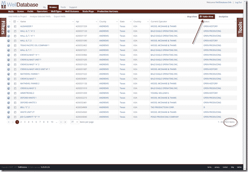
The list view shows that we have 422 wells returned for this particular search. We are under the plan limit, so we 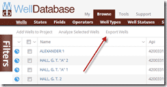 can now export. For this example, we will be exporting the entire dataset, but you can also select individual wells to export by simply clicking the checkbox next to the wells you are interested in and then clicking the Export Wells button. Again, we are exporting the entire dataset, so we will just go straight to clicking the Export Wells button without selecting any wells.
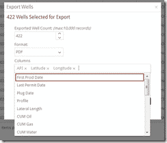
This brings up the Export Wells screen where we have our export options.
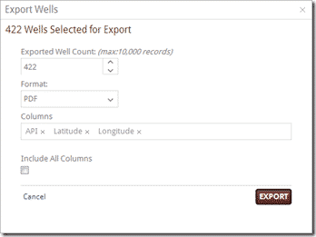
We can quickly see the confirmation of the number of wells we were expecting to be exported. Choose formats from Excel, CSV, Shape File, and many more. Below that we have the column list. The columns to export defaults to API, Latitude, & Longitude, but users can easily add columns to the list by simply clicking in the column field and choosing the column you want from the dropdown.
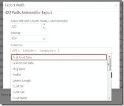
If you want to bypass the column selection and have every column exported, you can check the box under Include All Columns. Once you have all the columns you are interested in and the format chosen, click Export. For our example, we have chosen API, Well Name, Latitude, Longitude, CUM Oil, CUM Gas, and CUM Water. Below are the files exported from this example:
Excel Export
CSV Export
ShapeFile Export
We have worked to make WellDatabase a world class data management and analysis tool, but there will always be situations where it is necessary to export the data into separate systems for a variety of reasons. At WellDatabase, we are more than happy to empower our customers with the ability to export the data to use how they see fit.
Larger dataset exports coming soon.
If you’re not already a WellDatabase user, sign up here and start using the map today.
As always, feel free to contact us at support@welldatabase.com with any questions or comments.
This is just a quick follow up from our previous Alaska posts (see Alaska Data and WellDatabase Takes on Alaska). Here we will outline the data we...
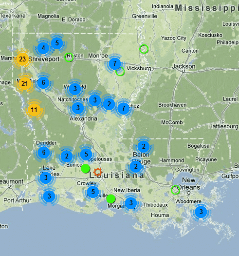
I thought we’d follow-up the WellDatabase vs SONRIS post with a quick rundown of the data available in our oil & gas database for Louisiana, and take...

Apparently questions grow on trees…